
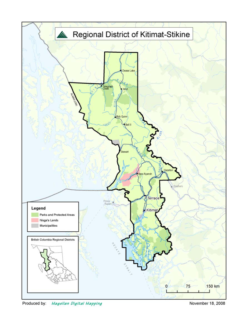
Old Skeena Bridge, Terrace BC
by the Kitimat-Stikine Regional District
Description of Historic Place
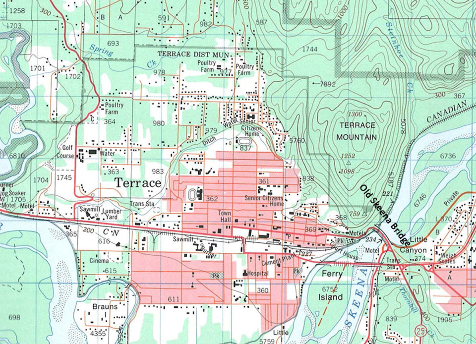
The Old Skeena Bridge, as it is locally known, is situated in northwestern British Columbia spanning the Skeena River between the city of Terrace and the community of Thornhill. It is approximately 650 metres northwest of the junction of Highways 16 and 37 and approximately 1.5 km upstream of the newer two lane Dudley Little, Skeena River Bridge.
This statement of significance will address the Old Skeena Bridge as well as the ramps which lead onto the bridge on either side. The Old Skeena Bridge spans approximately 300 metres across the Skeena River and the ramps leading onto the bridge are both approximately 50 metres in length. This historic site also includes the rock outcropping immediately below the western entrance to the bridge and the larger rock outcropping below the eastern end of the bridge. This larger rock outcropping stretches downstream approximately 100 metres from the bridge and approximately 200 metres from the shore (see map 2).
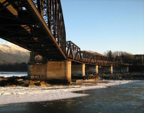
The Old Skeena Bridge was constructed using two different types of truss systems; a through truss and a deck truss. The through truss is the portion of the bridge where the trussing is suspended above the bridge deck and the deck truss is the portion of the bridge where the trussing is suspended below the bridge deck. The Old Skeena Bridge is currently constructed of metal beams, concrete abutments and piers and an open grated steel deck.
Heritage Value of the Historic Place
The Old Skeena Bridge replaced a bridge and ferry service that was located downstream a short distance at what is now called “Ferry Island”. This ferry service was susceptible to the changing water levels and could only carry a limited number of people and a certain size of vehicle. The building of the Skeena Bridge allowed community members of Terrace and other settlements in the region to move more freely and safely across the Skeena River.
The Old Skeena Bridge has significant heritage value because it is an important part of the historic development of transportation infrastructure within the region. The coming of the Grand Trunk Pacific Railway during the first decade of the 20th century spurred a period of transportation infrastructure development that would support the growing economy and increasing population. The railway brought people and new development to the area, creating a need for better established transportation systems. During the 1920’s there were rough roads and bridges being developed which served to connect settlements such as Thornhill, Usk, Lakelse Lake, Remo and the Kitsumkalum Valley. The roads built by early settlers heading east and west of Terrace were eventually finished as highways in 1944 by army personnel deployed to the region during World War II. Bridges like the Old Skeena Bridge were integral parts of this transportation infrastructure development.
The Old Skeena Bridge was opened to the public in 1925 but a major reconstruction and renovation of this bridge occurred in 1953 which altered the location and look of the bridge significantly. This reconstruction occurred due to the building of the railway bridge for the Kitimat‐Terrace CN railway expansion. The railway bridge is adjacent to the highway bridge on the downstream, or south facing, side of the bridge. Although this reconstruction used some of the old bridge spans it included the creation of many new Sleep spans and concrete piers. As well, this reconstruction included changing the entry and exit ramps and laying a new hardwood deck. The rock outcropping below the eastern entrance to the bridge was significantly altered at this time to allow for better access to the site. The reconstruction of the Old Skeena Bridge, made necessary by the expansion of the Kitimat‐Terrace CN Rail line, is important to the heritage value of this historic site as it redefined and updated the structure’s construction, location and appearance.
In 2001 the wooden deck that was laid during this reconstruction was replaced by a grated steel deck due to highway maintenance costs. The past use of this wood deck adds to the heritage value of the Skeena Bridge because for 48 years it was defined as the longest, one lane, wood decked, curved bridge in North America.
The Old Skeena Bridge also has heritage value because it contributed to the social and cultural development of the region. With freer and safer movement of people throughout the landscape relationships were built, ideas were more readily shared and economic opportunities were created.
Historical value can be assigned to the adjacent rock outcroppings at the bridge site because of the current and historic use of the site. Continuing the transportation theme, the rock outcroppings under the bridge that form Little Canyon was a formidable obstacle to sternwheeler riverboats on the Skeena River prior to the construction of the Grand Trunk Pacific Railway. These ringbolts anchored in the rocks were used to help the riverboats through the canyon on their upstream journey. Ringbolts are still visible in the rock outcrop at the west end of the bridge. Currently and historically the rock outcroppings were also used as a food, social and ceremonial fishing site by First Nations people.
In addition, the Old Skeena Bridge is used as a gathering site for a local celebration on the British Columbia Day long weekend in August. This annual community celebration facilitated in Terrace is called Riverboat Days and commemorates local history and builds community pride. The bridge site is used as a gathering spot for the fireworks celebration and is attended by thousands of local community members and visitors.
Character‐Defining Elements
The Character‐Defining Elements of the Old Skeena Bridge include:
● the physical relationship the Old Skeena Bridge has to the Kitimat‐Terrace railway bridge
● the appearance as a one lane curved bridge
● the current bridge structure including the concrete piers and steel trusses
● the old original bridge piers under the current bridge
● the plaque commemorating the bridge’s 75th anniversary attached to a truss on the west end of the bridge
● the use of the bridge as a transportation route across the Skeena River
● the use of the bridge and surrounding site as a community gathering place for celebration
● the rock outcropping under and adjacent to the bridge
● Riverboat ringbolts on the west end rock outcroppings
● natural features used by the First Nations for fishing
Maps
Map 1: Map of Regional District Kitimat‐Stikine and the general location of the Old Skeena Bridge.
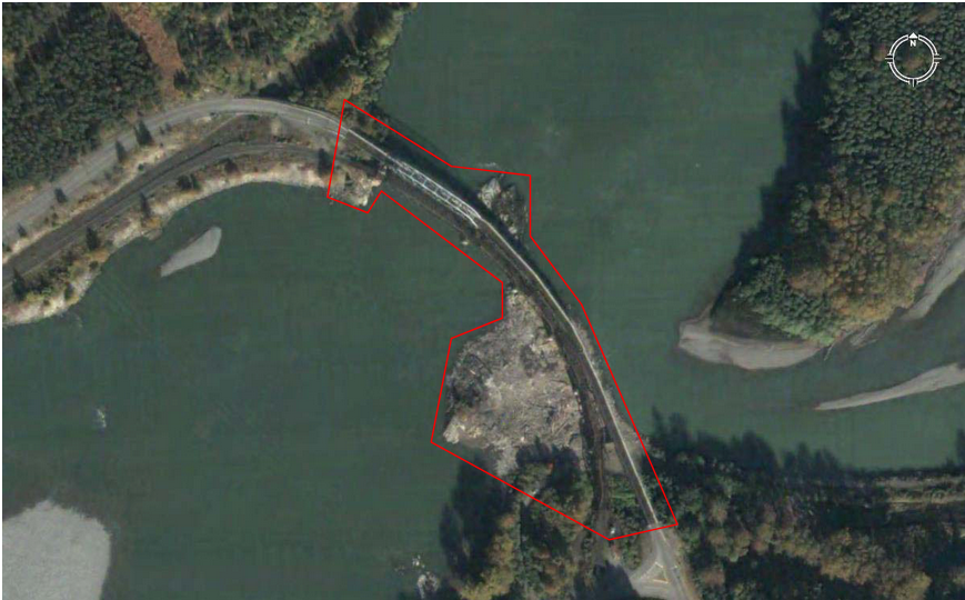
Map 2: Detailed aerial view of the Old Skeena Bridge with approximate site boundaries.
(Image Courtesy of Google Earth 2008)
Map 3: Map showing the Old Skeena Bridge, the community of Terrace and the surrounding contours and
corresponding elevations. (Portion of NTS Mapsheet 103I/10, Canadian Department of Energy,
Mines and Resources, 1980, 4th Edition)
Images
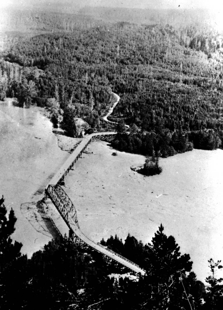
Image 1: Skeena Bridge during 1936 Flood
Image E‐01233 courtesy of Royal BC Museum, BC Archives
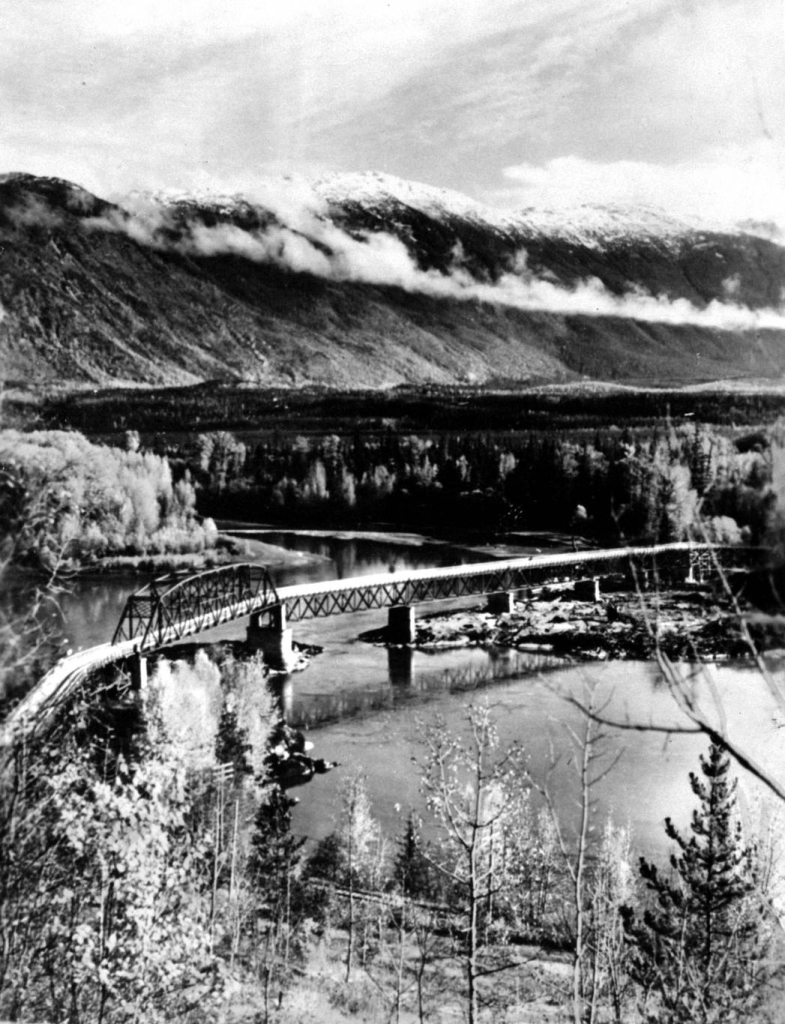
Image 2: View of Old Skeena Bridge.
Image E‐01728 courtesy of Royal BC Museum, BC Archives
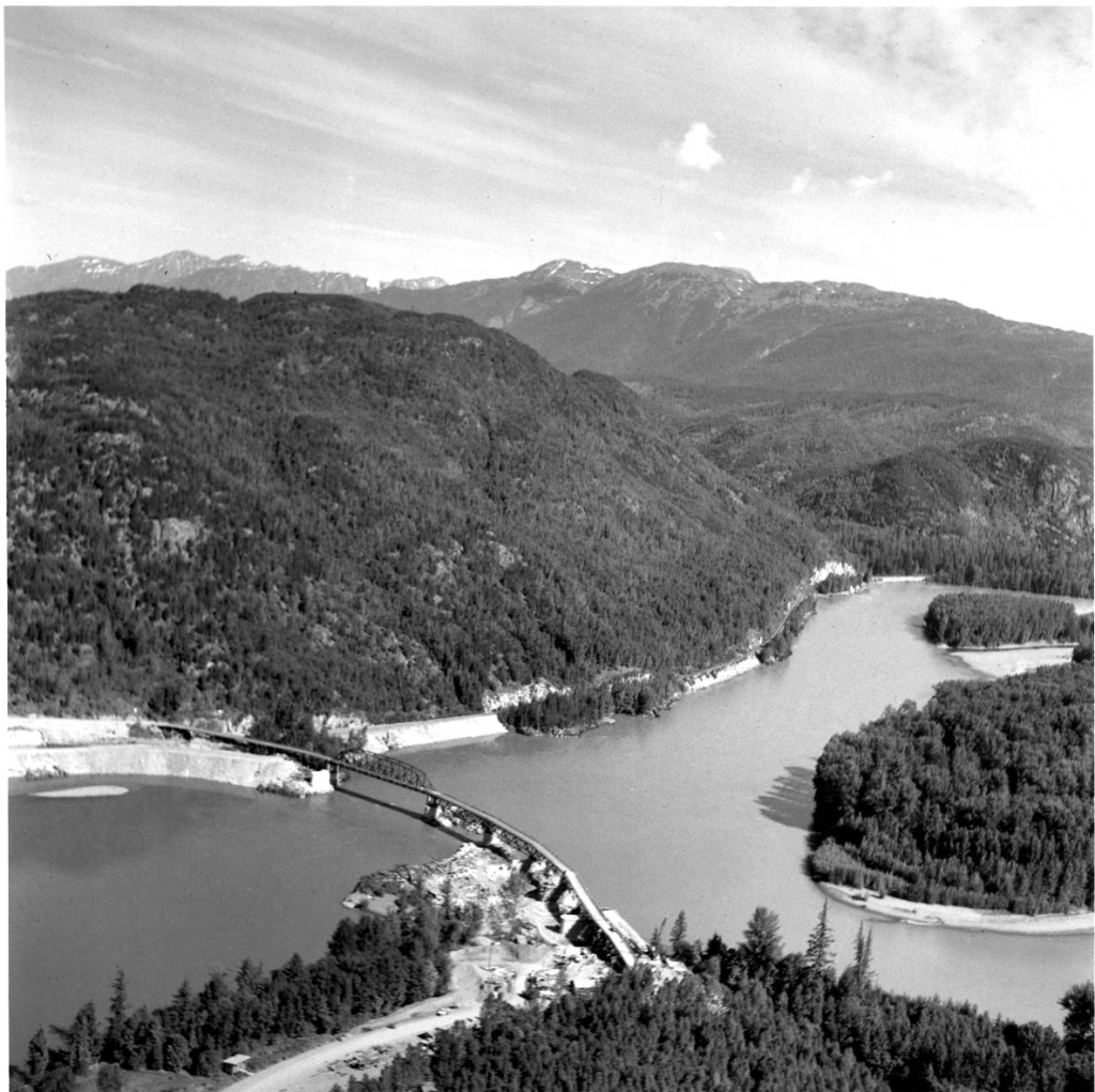
Image 3: View of the Skeena Bridge Prior to railway bridge construction.
Image courtesy of Kitimat Museum and Archives
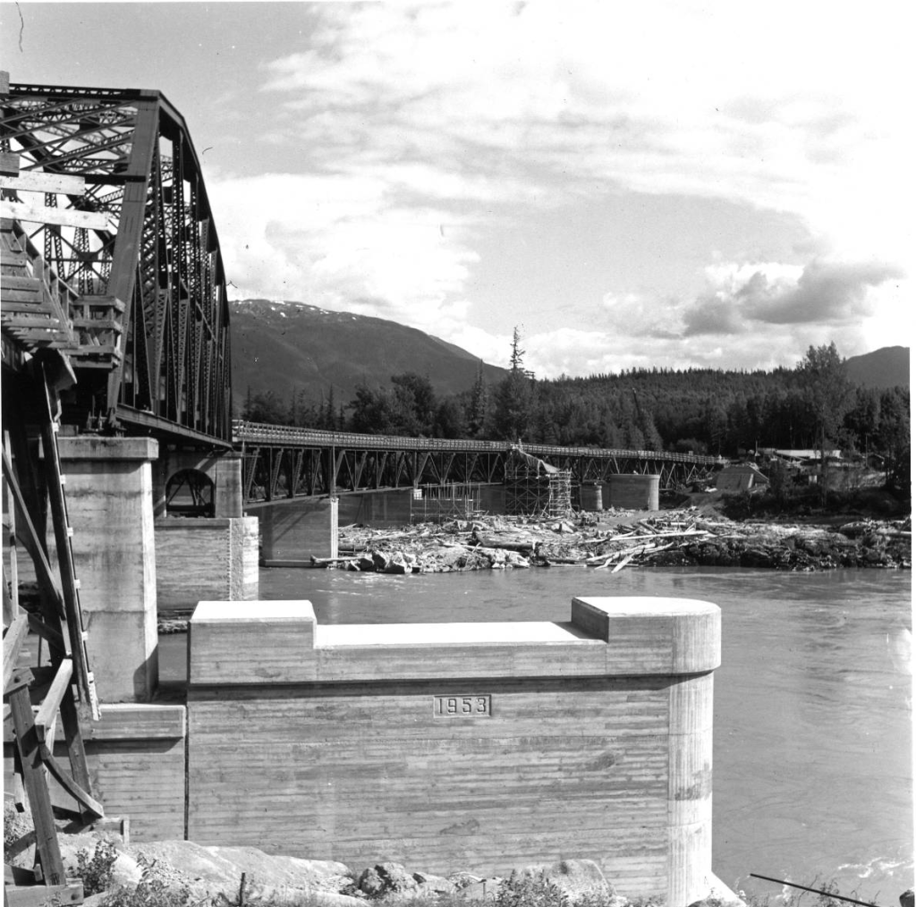
Image 4: View of Skeena Bridge after the reconstruction and prior to the building of the railway bridge.
Image courtesy of The Kitimat Museum and Archives
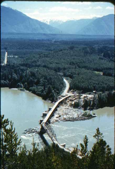
Image 5: View of concrete piers built for rebuilding of
Skeena Bridge prior railway bridge construction.
Image courtesy of Kitimat Museum and Archives
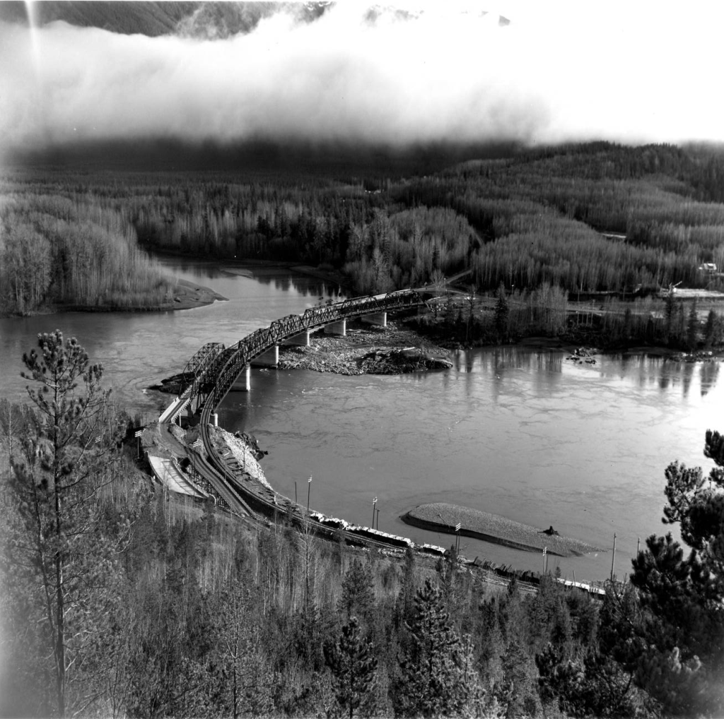
Image 6: View of Skeena Bridge with railway bridge beside. Note both
the old and new entry ramps for the Skeena Bridge are visible.
Image courtesy of The Kitimat Museum and Archives
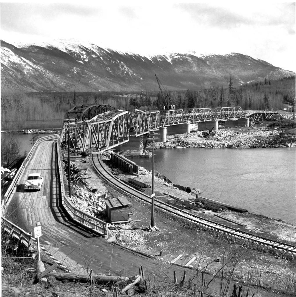
Image 7: View of Skeena Bridge c.1953.
Image Courtesy of Kitimat Museum and Archives
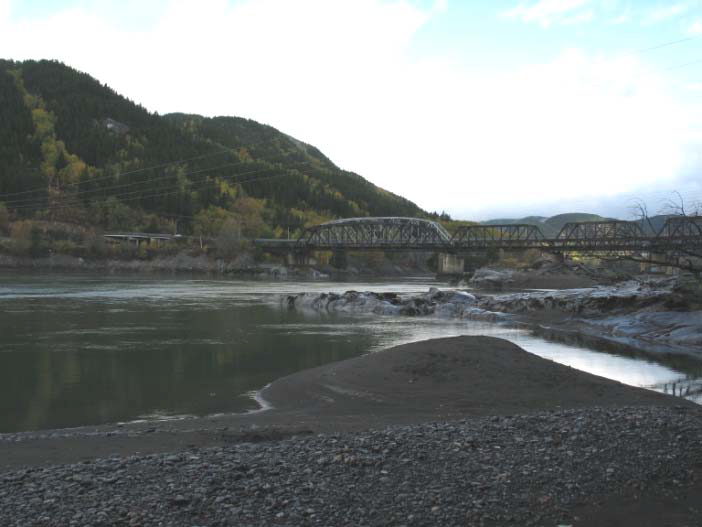
Image 8: View of Skeena Bridge and railway bridge 2008.
Image Courtesy of Cedarwood Consulting
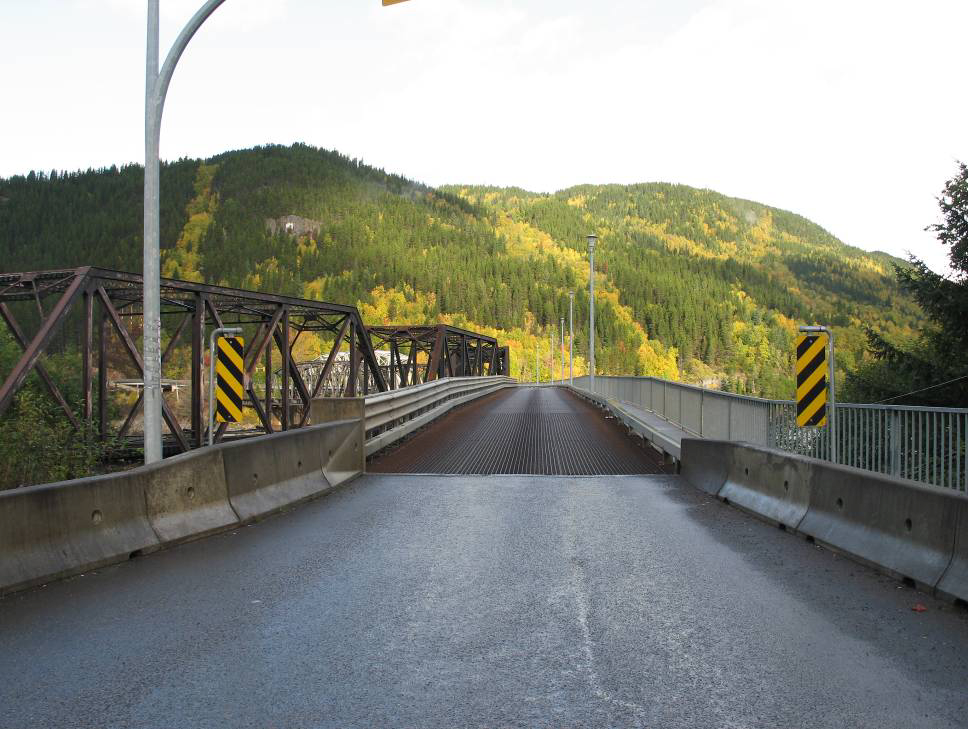
Image 9: View of the metal grated deck and ramp.
Photo courtesy of Cedarwood Consulting
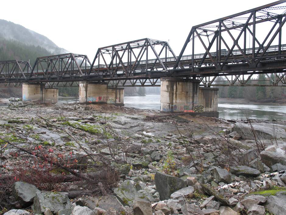
Image 10: View of bridge from rock outcropping below east end
of bridge. This area was altered and used as access while building the railway bridge.
Photo courtesy of Cedarwood Consulting
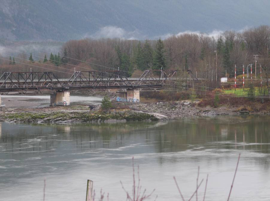
Image 11: View of rock outcropping at east end of bridge used as
a fishing site for net fishing.
Photo courtesy of Cedarwood Consulting
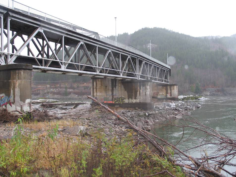
Image 12: View of bridge from upstream. Note the deck trusses.
Photo courtesy of Cedarwood Consulting
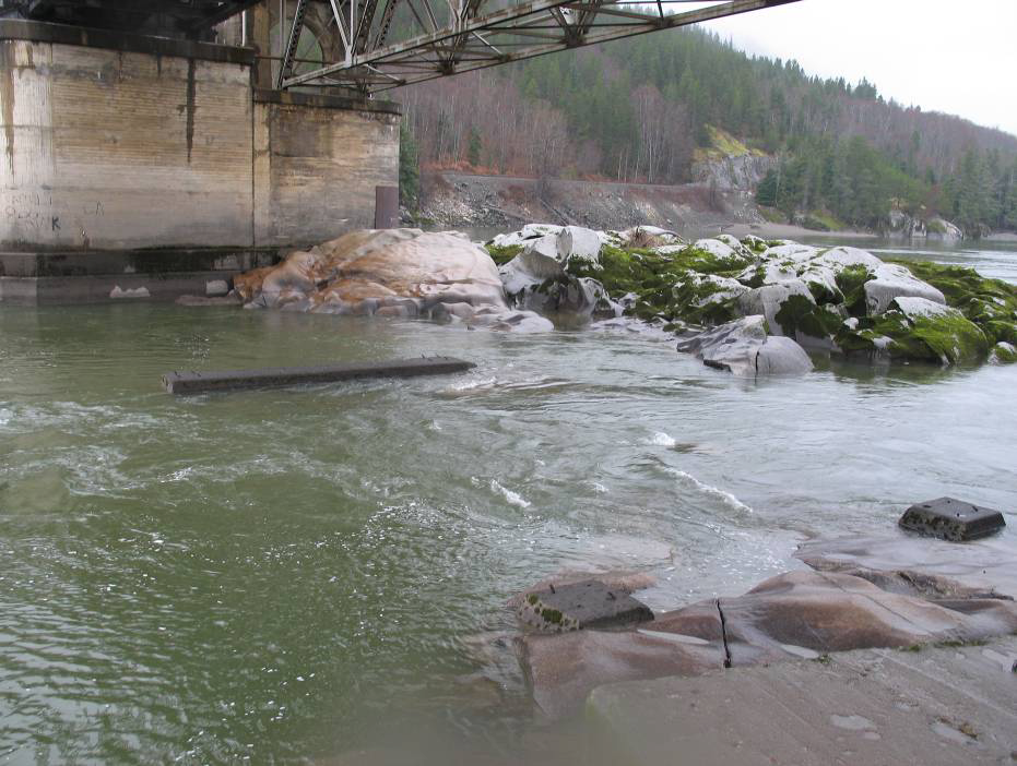
Image 13: View of original piers used for bridge from 1925‐53
located at water level in front of new pier.
Photo courtesy of Cedarwood Consulting
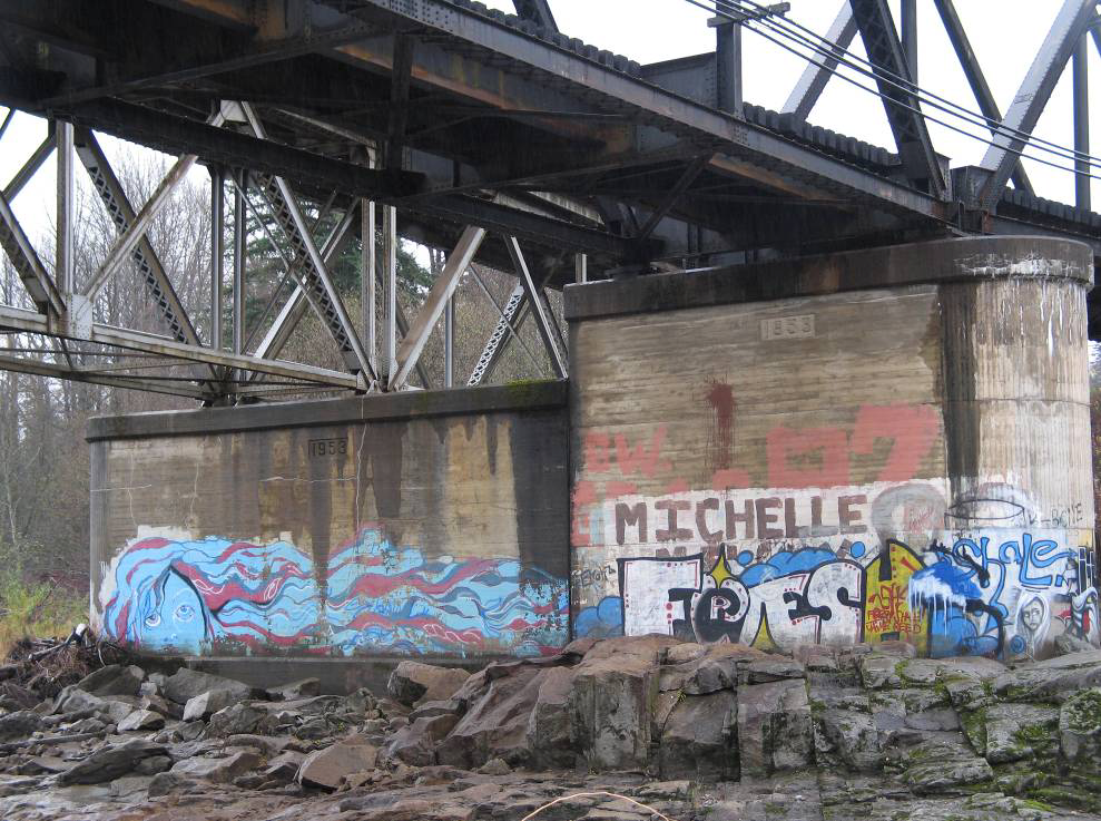
Image 14: View of both railway bridge and vehicle bridge piers with 1953
date stamped on them.
Photo Courtesy of Cedarwood Consulting
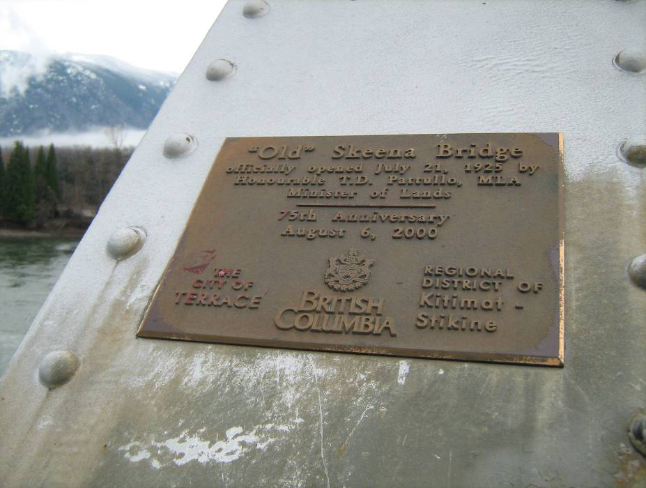
Image 15: 75th Anniversary Plaque on west end of bridge.
Photo Courtesy of Regional District Kitimat‐Stikine
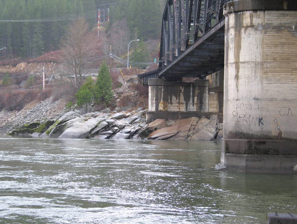
Image 16: View of Fishing Site at west end of bridge.
Photo Courtesy of Cedarwood Consulting
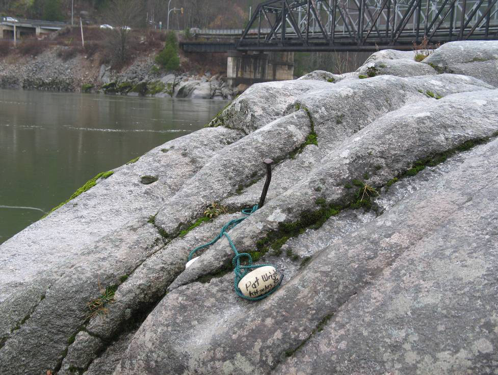
Image 17: View of fishing site used by a member of the Kitselas Nation
with bridge in the background.
Photo courtesy of Cedarwood Consulting

Image 18: View of Riverboat Ringbolts imbedded in rock outcroppings at west
end of the Old Skeena Bridge.
Photo courtesy of The Regional District of Kitimat‐Stikine
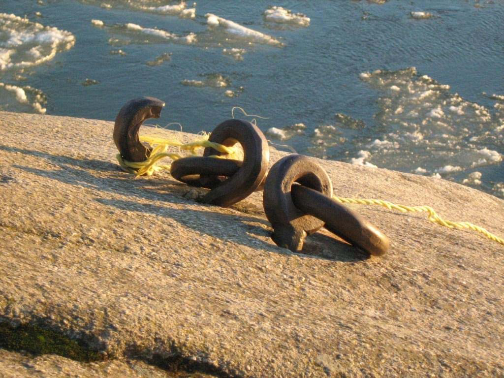
Image 19: Close up view of the Riverboat ringbolts imbedded in the rock outcropping on the west end of
the Old Skeena Bridge.
Photo courtesy of Regional District of Kitimat‐Stikine
Sources:
Asante,Nadine
1972 The History of Terrace. Terrace Public Library Association: Terrace BC.
Buckland & Taylor
2005 Buckland & Taylor Ltd: Bridge Engineering. Electronic document,
http://www.t.com/projects/hagwil.htm , accessed October 25, 2008.
Cridlebaugh
2001 Bridge Basics. Electronic Document,
http://pghbridges.com/basics.htm , accessed October 10, 2005.
Frank, Floyd
1991 My Valley’s Yesteryears. Orca Book Publishing Ltd: Victoria.
McElhanney Consulting Services Ltd.
2008 Old Skeena Bridge Rehabilitation. Electronic document,
http://www.mcelhanney.com/mcsl/projects/SkeenaBridge/project.php , accessed
October 7, 2005.
Terrace Public Library
2001 Terrace Public Library History Link. Electronic documents and historic photographs,
http://www.terracelibrary.ca/history1/index.htm , accessed October 6, 2008.
Terrace Historical Society
2005 The 1920’s: The Skeena Bridge. Electronic document,
http://www.terracelibrary.ca/trhs/bridge.html, accessed October 20, 2008.
Wells, Richard
2007 Oral History Interview with Richard Wells. Kitimat Musuem and Archives Audio Collection.
Wikipedia
2008 Wikipedia. Electronic document, http://en.wikipedia.org/wiki/Terrace,British Columbia ,
accessed October 10, 2008.
You can download this document in PDF format from the Regional District website:
https://www.rdks.bc.ca/our_region/heritage_culture/heritage_sites
◀
